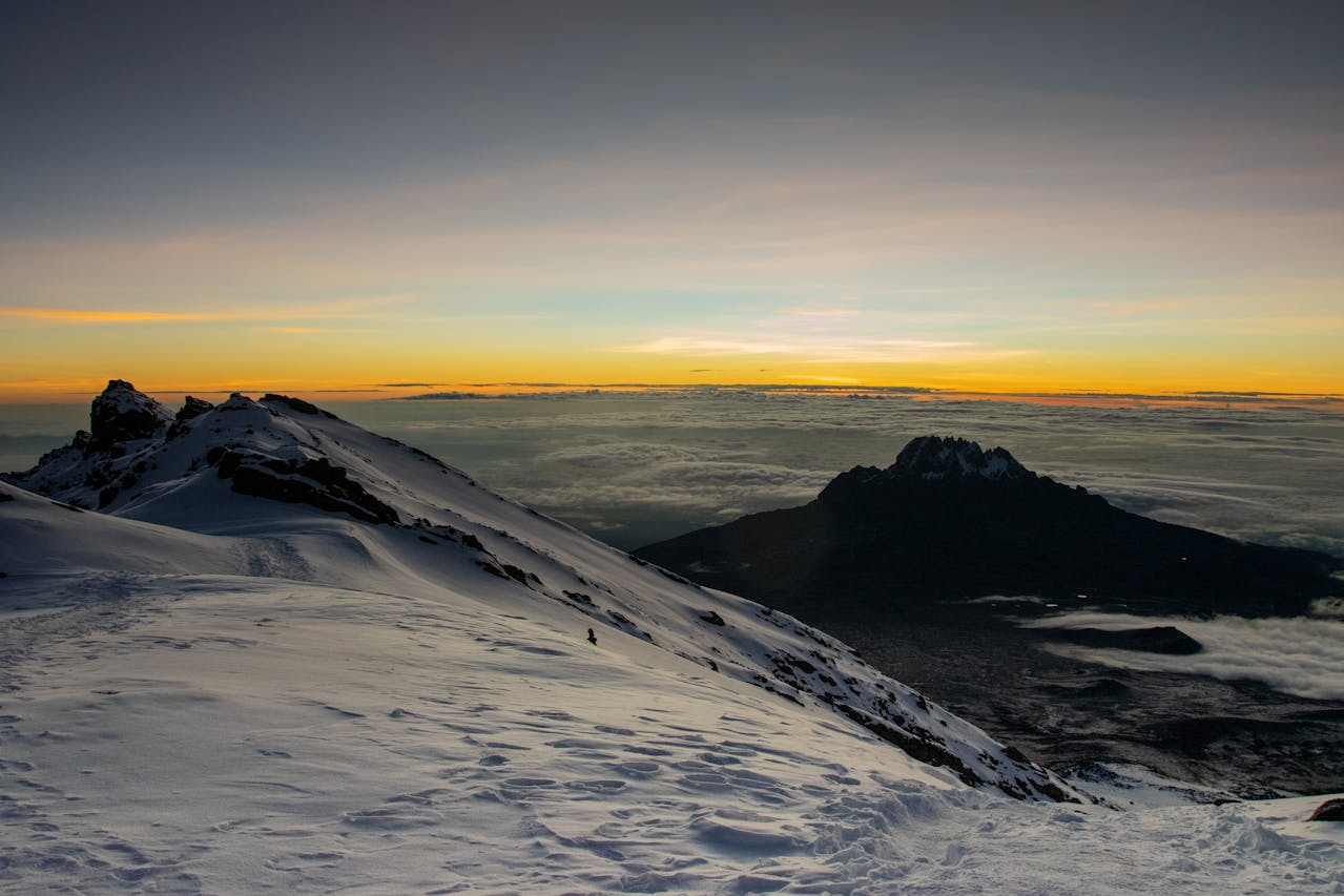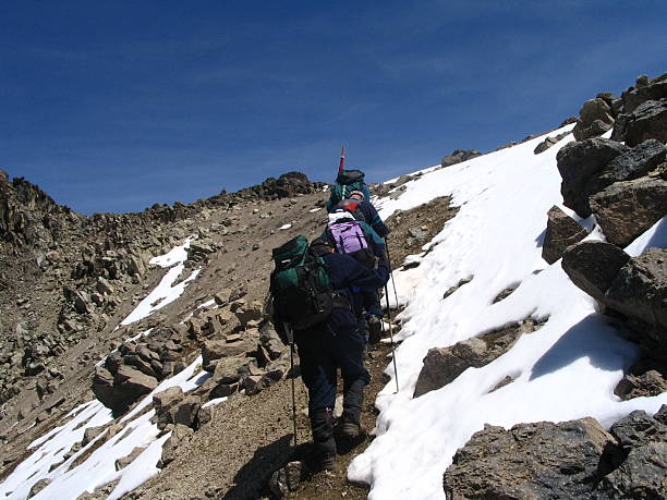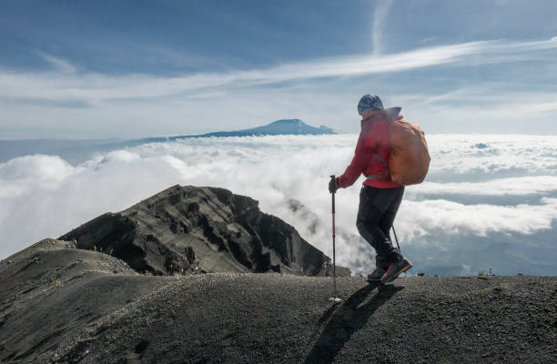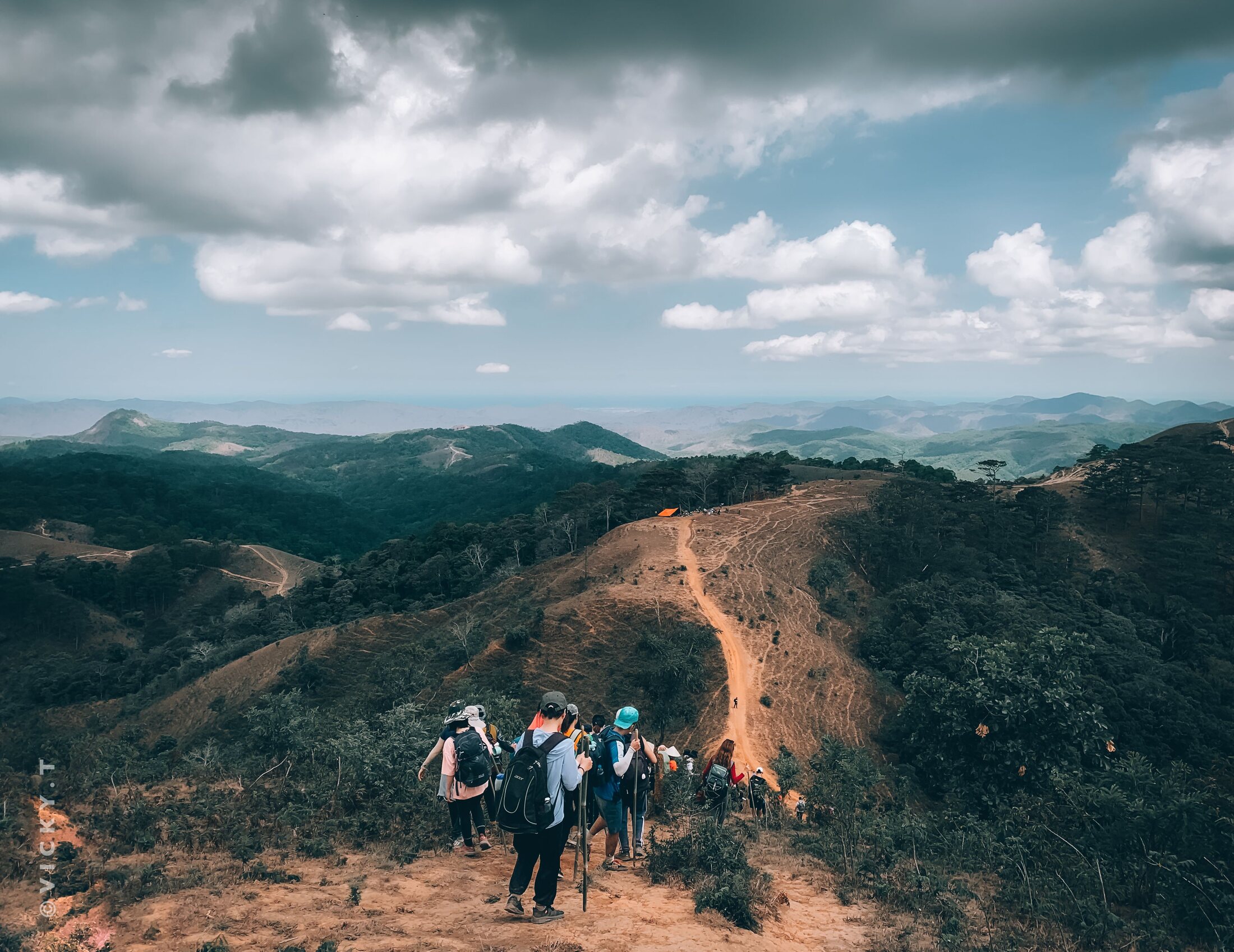
The 6 Days Rongai Route Kilimanjaro climb offers a different perspective of Mount Kilimanjaro from routes that begin on the southern or western sides. The trail starts near the northeastern foothills and gradually climbs through forest, heath, moorland and increasingly dry high-altitude terrain.
The route is often chosen by trekkers who prefer a quieter approach and broad views toward Mawenzi. After the first nights around Simba and Kikelewa, the itinerary reaches Mawenzi Tarn, one of the most scenic high camps on the route.
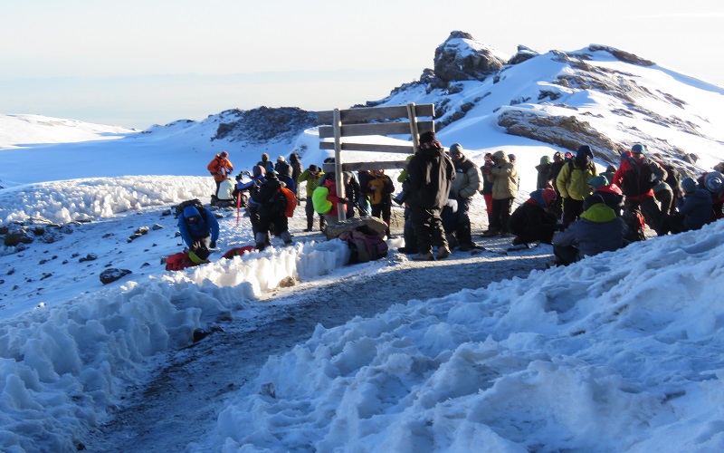
From Mawenzi Tarn, the trail crosses the high saddle toward Kibo Hut, the base for the summit attempt. Summit night follows the crater rim toward Uhuru Peak at 5,895 meters when conditions and trekker health allow.
After the summit attempt, the descent follows the Marangu side of the mountain through Horombo before finishing at Marangu Gate on Day 6.
6 Days Rongai Route Kilimanjaro Route
6 Days Rongai Route at a Glance
| Day | Route | Approx. Elevation | Main Experience | Overnight |
|---|---|---|---|---|
| Day 1 | Rongai Gate → Simba Camp | ~1,950 m → ~2,625 m | Forest and heath transition | Simba Camp |
| Day 2 | Simba Camp → Second Cave → Kikelewa Camp | ~2,625 m → ~3,600 m | Moorland ascent and broad northern views | Kikelewa Camp |
| Day 3 | Kikelewa Camp → Mawenzi Tarn | ~3,600 m → ~4,330 m | High camp beneath Mawenzi and acclimatization | Mawenzi Tarn Camp |
| Day 4 | Mawenzi Tarn → Kibo Hut | ~4,330 m → ~4,700 m | Crossing the high saddle toward summit base | Kibo Hut / Kibo Camp |
| Day 5 | Kibo → Uhuru Peak → Horombo | ~4,700 m → 5,895 m → ~3,720 m | Summit attempt and long descent | Horombo Hut |
| Day 6 | Horombo Hut → Marangu Gate | ~3,720 m → ~1,860 m | Final moorland and rainforest descent | Trek Ends |
6 Days Rongai Route Highlights
Northeastern Approach
Begin from a different side of Kilimanjaro than Machame, Lemosho and Marangu ascent routes.
Quieter Trail Atmosphere
Experience sections that can feel less crowded than some of Kilimanjaro's heavily used southern trails.
Mawenzi Tarn
Camp beneath the dramatic Mawenzi massif in one of the route's most memorable high-altitude settings.
High Saddle Crossing
Cross the exposed high-altitude saddle between Mawenzi and Kibo before reaching summit base.
Uhuru Peak – 5,895 m
Attempt to reach the highest point on Mount Kilimanjaro and the highest point in Africa.
Marangu Descent
Descend on a different side of Kilimanjaro through Horombo and finish at Marangu Gate.
Detailed 6 Days Rongai Route Kilimanjaro Itinerary
Rongai Gate to Simba Camp
After breakfast at your hotel in Moshi or another agreed pickup location, meet your mountain crew and begin the road journey toward the northeastern side of Mount Kilimanjaro.
At the starting gate, your guide completes registration and park procedures while porters organize food, equipment and permitted personal duffel loads.
Begin trekking through the lower forest and heath zone. The northeastern side of the mountain has a different character from the wetter southern slopes, although weather conditions can still change quickly.
Walk slowly from the beginning and use the first day to establish a comfortable trekking rhythm.
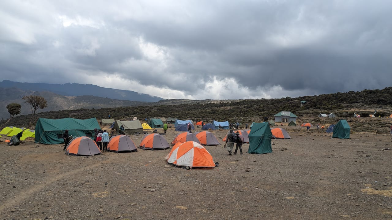
Arrive at Simba Camp at approximately 2,625 meters. Settle into camp, change into warm clothing and hydrate well.
Dinner is prepared by the mountain cook before your guide provides the next day's briefing.
Rongai Gate (~1,950 m) → Simba Camp (~2,625 m)Simba Camp to Kikelewa Camp via Second Cave
After breakfast, continue upward into more open heath and moorland terrain.
The route generally passes through the Second Cave area before continuing toward Kikelewa. As vegetation becomes lower, views of the northern slopes and Mawenzi may open up in clear conditions.
The day gains substantial elevation, so steady pacing and regular hydration remain important.
Short breaks allow time to eat, drink and adjust clothing as temperatures and wind conditions change.
Continue toward Kikelewa Camp at approximately 3,600 meters. The camp provides a higher sleeping elevation before the climb toward Mawenzi Tarn.
Rest, hydrate and enjoy dinner at camp.
Simba Camp (~2,625 m) → Second Cave → Kikelewa Camp (~3,600 m)Kikelewa Camp to Mawenzi Tarn Camp
After breakfast, begin a steeper climb toward Mawenzi Tarn. The terrain becomes increasingly dramatic as the route approaches the jagged Mawenzi massif.
The climb is shorter in distance than some earlier days but gains considerable elevation.
Arrive at Mawenzi Tarn Camp at approximately 4,330 meters, situated beneath the slopes of Mawenzi.
Depending on guide planning, weather and group condition, the afternoon may include an additional short acclimatization walk to a higher point before returning to camp.
This higher-elevation exposure can help prepare the body for the following day's crossing to Kibo.
Return to camp, rest, hydrate and enjoy dinner.
Kikelewa Camp (~3,600 m) → Mawenzi Tarn Camp (~4,330 m)Mawenzi Tarn Camp to Kibo Hut
After breakfast, leave Mawenzi Tarn and begin crossing the broad high-altitude saddle between Mawenzi and Kibo.
The landscape is dry, open and exposed, with very little vegetation. Wind and strong sun can both be significant depending on conditions.
Continue at a controlled pace toward Kibo Hut at approximately 4,700 meters.
Because the summit attempt begins later that night, the afternoon is used mainly for rest, hydration and preparation.
Organize summit clothing, warm layers, headlamp, gloves, water and snacks. Eat an early dinner and listen carefully to your guide's summit briefing.
Rest for several hours before waking late at night.
Mawenzi Tarn (~4,330 m) → Kibo Hut (~4,700 m)Kibo Hut to Uhuru Peak – Descend to Horombo Hut
Wake late at night and prepare for the summit attempt. After a light meal or hot drink, begin climbing slowly in darkness.
The ascent above Kibo is steep, cold and physically demanding. Headlamps illuminate the route as the group follows a slow zigzag path over loose volcanic terrain.
Continue toward Gilman's Point on the crater rim at approximately 5,685 meters.
Reaching the crater rim is a major achievement, but trekkers who are healthy enough may continue along the rim toward Uhuru Peak.
If weather, mountain conditions and health allow, reach Uhuru Peak at 5,895 meters, the highest point on Mount Kilimanjaro and the highest point in Africa.
Time at the summit is usually limited because of the cold and extreme altitude. Take photographs, follow your guide's instructions and begin descending when directed.
Return toward Kibo for a short rest and food before continuing the long descent to Horombo Hut.
Arrive at Horombo later in the day for dinner and overnight.
Kibo Hut (~4,700 m) → Uhuru Peak (5,895 m) → Horombo Hut (~3,720 m)Horombo Hut to Marangu Gate – Transfer to Moshi
After breakfast, begin the final descent from Horombo toward Marangu Gate.
The trail passes from moorland back into thicker forest as elevation decreases.
Although descending is easier on the cardiovascular system, the long downhill walk can still place stress on knees and leg muscles.
Continue toward Marangu Gate and complete the necessary park exit procedures.
Meet the transfer vehicle and return to Moshi or another agreed destination.
This completes your six-day Rongai Route Kilimanjaro climb.
Horombo Hut (~3,720 m) → Marangu Gate (~1,860 m) → MoshiWhy Choose the 6-Day Rongai Route?
- Northeastern approach to Mount Kilimanjaro
- Quieter trail atmosphere on many sections
- Mawenzi Tarn high-altitude camp
- Possible acclimatization walk around Mawenzi
- High saddle crossing toward Kibo
- Summit attempt from Kibo Hut
- Different descent through Horombo and Marangu Gate
- Professional mountain crew support
Rongai Route Accommodation
Camping on the Ascent
Overnight accommodation on the lower and middle Rongai section is generally in mountain tents at designated camps.
Kibo Summit Base
The high summit base is around Kibo Hut, where trekkers rest before beginning the overnight summit attempt.
Horombo on Descent
After the summit attempt, the route joins the Marangu side and normally uses Horombo for the final mountain overnight.
Altitude Profile
| Location | Approx. Elevation | Zone | Main Consideration |
|---|---|---|---|
| Rongai Gate | ~1,950 m | Lower forest / heath | Begin slowly and establish a steady pace |
| Simba Camp | ~2,625 m | Heath / moorland transition | Hydration and early adaptation |
| Kikelewa Camp | ~3,600 m | Moorland | Monitor response to increasing elevation |
| Mawenzi Tarn | ~4,330 m | High alpine terrain | Important acclimatization stage |
| Kibo Hut | ~4,700 m | Alpine desert | Rest and prepare for summit night |
| Gilman's Point | ~5,685 m | Crater rim | Major summit milestone |
| Uhuru Peak | 5,895 m | Extreme altitude | Follow guide instructions and descend when required |
| Horombo Hut | ~3,720 m | Moorland | Recovery after the summit descent |
Rongai Route Acclimatization
The six-day Rongai itinerary gains altitude progressively through Simba, Kikelewa and Mawenzi Tarn before reaching Kibo. Mawenzi Tarn can also be used for additional acclimatization activity according to guide planning.
- Walk slowly from the first trekking day
- Drink regularly throughout the climb
- Eat enough even if appetite decreases
- Use Mawenzi Tarn as an important acclimatization stage
- Report headaches, nausea, dizziness or unusual fatigue
- Never hide worsening altitude symptoms
- Follow the guide's decision if descent is required
Rongai Route vs Machame Route
Rongai Route
Approaches Kilimanjaro from the northeast, passes close to Mawenzi, crosses toward Kibo and descends through Marangu.
Machame Route
Approaches from the southwest, crosses the Shira Plateau, uses Lava Tower and Barranco, and normally reaches summit base at Barafu.
Best Time to Climb the Rongai Route
| Period | General Conditions | Trail Experience | Important Note |
|---|---|---|---|
| January – March | Often relatively dry with changing mountain weather | Good climbing period with mixed visibility | Summit temperatures remain very cold |
| April – May | Higher chance of rain | Wetter conditions and quieter trail periods | Waterproof protection is especially important |
| June – October | Generally drier period | Popular Kilimanjaro climbing season | Northeastern slopes can still experience wind and cold |
| November – December | Possible short rains and variable weather | Mixed trail conditions | Mountain weather remains unpredictable |
Meals and Drinking Water
Meals are prepared by the mountain cook and generally include breakfast, lunch and dinner during the climb according to the confirmed package.
Appetite can decrease at altitude, but maintaining adequate food intake remains important for trekking energy and recovery.
Drinking water is collected and treated according to the mountain operation. Bring reusable water containers and follow your guide's hydration instructions.
Professional Rongai Route Mountain Crew
Your mountain team normally includes a licensed Kilimanjaro guide together with porters, a mountain cook and support staff appropriate for the group size and park requirements.
Guides manage pacing, route decisions, altitude monitoring and daily briefings. Porters transport group equipment and permitted personal loads, while cooks prepare meals during the climb.
What to Pack for the 6-Day Rongai Route
Clothing
- Moisture-wicking base layers
- Warm fleece or insulated mid-layer
- Waterproof outer jacket
- Waterproof trekking trousers
- Warm summit jacket
- Thermal underwear
- Warm hat
- Sun hat
- Warm gloves
- Hiking socks
Trekking Essentials
- Broken-in hiking boots
- Daypack
- Headlamp and spare batteries
- Trekking poles
- Reusable water bottles or hydration system
- Sunglasses
- Sunscreen
- Personal medication
- Small personal first-aid supplies
- Waterproof protection for personal gear
6 Days Rongai Route Includes and Excludes
Package Includes
- Transfer from agreed hotel to Rongai starting gate
- Transfer from Marangu Gate after the climb
- Kilimanjaro National Park fees listed in the confirmed quotation
- Mountain camping accommodation on the Rongai ascent
- Applicable Kibo and Horombo sleeping arrangements according to the confirmed itinerary
- Professional licensed Kilimanjaro guide
- Porters according to park rules and group requirements
- Mountain cook and crew support
- Breakfast, lunch and dinner during the climb
- Drinking water arrangements on the mountain
- Rescue-related park fees where included in the confirmed package
- Applicable taxes stated in the quotation
Package Excludes
- International flights
- Tanzania visa costs
- Travel and medical insurance
- Personal trekking equipment
- Sleeping bag unless specifically listed as included
- Personal medications
- Guide, porter and cook gratuities
- Alcoholic and premium drinks
- Hotel accommodation before or after the trek unless included
- Airport transfers unless specifically included
- Emergency costs not covered by insurance or the package
- Items not specifically listed as included
Frequently Asked Questions
Where does the Rongai Route start?
The Rongai Route begins on the northeastern side of Mount Kilimanjaro.
How long is this itinerary?
This page describes a six-day Rongai Route itinerary including the summit attempt and descent to Marangu Gate.
Is Rongai a camping route?
Yes. The ascent generally uses mountain camps, while the route reaches the Kibo area and later descends through Horombo on the Marangu side.
What is special about Mawenzi Tarn?
Mawenzi Tarn is a dramatic high-altitude camp below Mawenzi and provides an important stage before crossing toward Kibo.
Is there an acclimatization opportunity?
Yes. Depending on guide planning and group condition, additional acclimatization walking may be possible around Mawenzi Tarn.
Where does summit night begin?
The summit attempt normally begins from the Kibo area at approximately 4,700 meters.
Do we pass Gilman's Point?
Yes. The standard Rongai summit approach reaches Gilman's Point on the crater rim before continuing toward Uhuru Peak when conditions allow.
What is the highest point?
Uhuru Peak is 5,895 meters above sea level.
Is technical climbing required?
The standard Rongai Route is a trekking route and generally does not require technical mountaineering skills.
Can beginners climb Rongai?
Beginners with suitable fitness, preparation and realistic expectations can attempt the route, but altitude remains the main challenge.
Is Rongai quieter than Machame?
Rongai can feel quieter on many sections than some popular southern routes, although actual trail traffic varies by season.
Can trekking gear be rented?
Selected trekking equipment may be available for rental in Moshi or Arusha depending on operator inventory.
Can airport transfers be arranged?
Yes. Transfers between Kilimanjaro International Airport, Moshi, Arusha and your hotel can be added.
Can Rongai be combined with a safari?
Yes. A Northern Tanzania wildlife safari can be arranged before or after the Kilimanjaro climb.
Can Zanzibar be added after the climb?
Yes. A Zanzibar beach holiday can be combined with the Rongai Route climb and optional safari.
Can the itinerary be customized?
Yes. Hotel nights, airport transfers, trekking dates, equipment arrangements, safari extensions and Zanzibar can all be customized.
Book Your 6 Days Rongai Route Kilimanjaro Climb
Approach Kilimanjaro from the quieter northeastern side, trek through Simba and Kikelewa, camp beneath Mawenzi, cross toward Kibo and attempt Uhuru Peak at 5,895 meters before descending through Marangu.
Send Epic Summit Safaris your preferred climbing dates, number of trekkers, pickup location, hotel requirements and equipment needs to receive a personalized Rongai Route quotation.
Request Your Kilimanjaro Quote